Bald Mountain aka Baldy Mountain aka Mount Baldy as it is commonly referred to, is a 13er situated in the Front Range of the Colorado Rockies. One of Breckenridge, Colorado’s best scenic peaks to hike in summer, Bald Mountain’s barren pinnacle offers some of the best 360-degree views in the state. Discover Summit County from this geological wonder peak and prepare to have your breath stolen. 
Mount Baldy Hike Quick Facts
Elevation: 13,690 feet Prominence: 2,099 feet Coordinates: 39°26’38”N 105°58’10”W Location: Summit County, Colorado, U.S. Mountain Range: Front Range Activities: Hiking, Skiing, Mountaineering Attractions: Stunning 360-degree views Season: Best hiked in summer (June through October) Trailhead: Off Boreas Pass and Baldy Road (CR-520)
Directions to Bald Mountain Trailhead From Baldy Road (CR-520)
From Breckenridge, drive down Main Street to the south side of town. At the last lighted intersection, make a left (head east) onto Boreas Pass Road. In approximately 2 miles turn onto Baldy Road (County Road 520). Soon you will arrive at the Bald Mountain Trailhead winter lot. You can start your hike from here or continue to the second parking area located about a half mile up the dirt road. If you have four-wheel drive with decent clearance, you can keep following the dirt road past the Iowa Mill all the way up to the final parking area. After you pass an electrical hut with radio antennas, the road will come to an end at its final landing zone from which you’ll begin your up hike to Bald Mountain’s summit. 
Explore Bald Mountain and Hike up to North America's 82nd Highest Peak
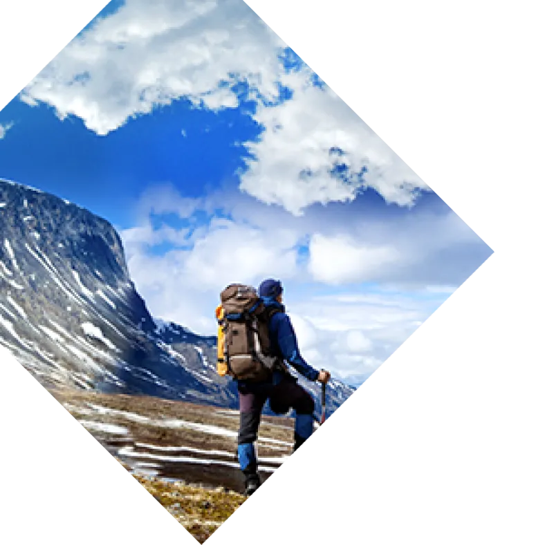
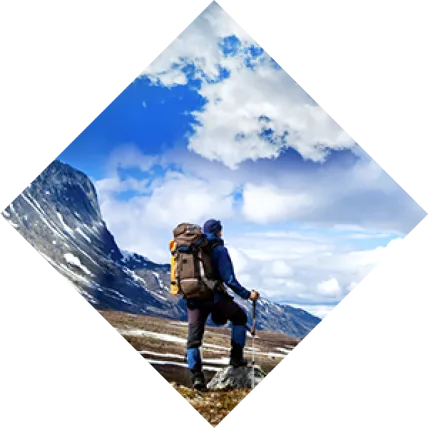
My best friend Hannah and I hop onto Interstate 70 and cruise over the pass. It’s a weekday and tourist season is behind us, so we find ourselves living one of those rare and surreal Colorado moments when the highways are trafficless and we’re stoked to be on the road. Having successfully traversed Swan Mountain, we head for Boreas Pass Road, the route to the Bald Mountain trail. Forming much of Breckenridge, Colorado’s eastern boundary, Mount Baldy sits southeast of downtown Breckenridge in the Arapaho National Forest. Though there are 27 Bald Mountains in Colorado, this one, at 13,690 feet in elevation, towers over them. Turning onto Baldy Road (CR-520), we continue past the first two parking areas and the Iowa Mill, a remnant of the mountain’s mining past. This area, along with the rest of Colorado (and then some), was once fully submerged under an ancient sea. It wasn’t until some 55 to 80 million years ago that the uplift of the Rocky Mountains created the Front Range upon which we’re cruising. Due to its rich geology, the area abounds in mining history and we see old, dilapidated remnants of its hay day on our ascent. Comforted, we notice that nature is taking its course by slowly swallowing what remains of the man-made structures that once defined its slopes. Arriving at the last and final landing before the road becomes too treacherous to ascend by car, we park facing the equally bald Mount Guyot to our east. Red toned and towering at 13,376 feet above sea level, Mount Guyot’s summit sits directly atop the Rocky Mountain Continental Divide. As its name implies, after an initial thin layer of pine trees at its base, Bald Mountain is indeed rather barren. Rumbling up its rocky, desolate alpine tundra, we note a warm-toned landscape with little vegetation. To survive at this altitude under rocky, exposed high alpine tundra conditions, plants must be hardy and low to the ground, so aside from a smattering of small weeds, a few resilient little grass bunches, and some short, desert-like shrubbery, nothing of consequence grows above treeline.  We begin our hike walking south and though the trail is not well-defined, one would be hard-pressed to get lost on Baldy’s prominent ridgeline. The views up here are incredible. To the northwest lies downtown Breckenridge and the slopes of the Tenmile Range, which boasts some of the oldest rocks in Colorado, dating back 1.7 billion years. In contrast, some of the rocks found on Bald Mountain are as young as 30 million years old. Gazing north we can see Swan Mountain and the Dillon Reservoir, over which we had traveled on our way into town. Just east of the reservoir is the backside of Keystone Resort. After an easy couple mile ascent that includes a few false summits and multiple photo stops we reach the top. The true summit is marked by a cairn and a wind shelter. While it’s generally an 8.2-mile out-and-back endeavor, managing to drive to the final parking area will allow you to shave off a good 5 miles in hiking distance. Though rated a Class 2 difficulty trail due to its general ambiguity and the possibility of having to put your hands down for stability, Bald Mountain is a great beginner hike for all. Standing above Mount Guyot, we’re no longer obstructed by its reddish peak and can see the layers of mountains beyond it. To our south lie Boreas Mountain and the famous flatlands of South Park, Colorado, a town so windy that my 100-pound frame is often unable to close car doors against its gusts.
  Separated from the world, with no other humans in sight, we’re blissfully free from the sounds of voices, humming of engines, and revving of power tools. Up here, everything is beautiful.
Be sure to check out Dagmara's Mt. Baldy Gear Guide here to learn what to bring on the trail!