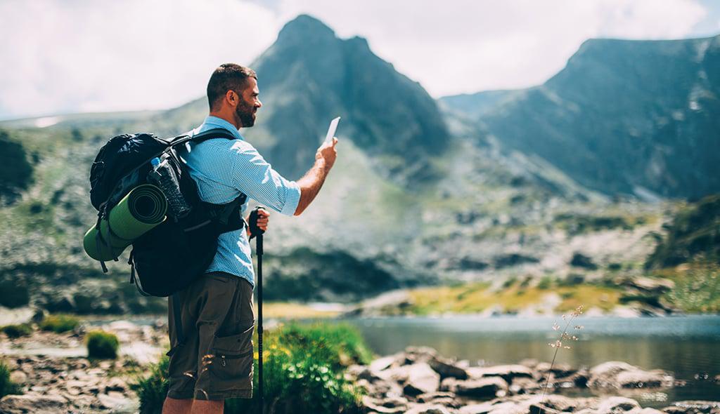
 Looking for the best hiking apps? We hate to break it to you, but they may not exist yet. Let’s have a moment of silence as we ponder this. In this modern era, it’s hard to believe that a few hiking apps don’t dominate the outdoor market. After all, how is that possible when our phones have virtually become everything from a personal assistant to a radio and a small computer? But, it’s true: the industry hasn’t been able to figure out what makes a true outdoorist happy. Part of the challenge may be in the fact that outdoor-types don’t tend to be heavily involved in the digital space beyond sharing Instagram adventures. As such, many existing apps are buggy or simply do not offer the type of information that hikers truly want and need. And, of course, most of us lose cell service five minutes after walking into the woods. If your app relies on data, you can forget about it. All that said, I don’t want you believing that it’s a lost cause! While I have yet to discover the perfect and best hiking app in the world, I’ve definitely discovered a few that I know, enjoy, and use on a regular basis. Check out a few of my favorites below.
The best hiking apps available
PeakFinder Earth ($4.99)
In practice, PeakFinder Earth is a gem of an app — when it functions at its prime. The concept is simple; hold your camera up to a mountain or range in front of you and the app will identify the peaks you are looking at. When PeakFinder performs as planned, it can be a lot of fun to name summits in the distance or, heck, even naming the peak you are actually climbing can be rewarding. The downside to this app is twofold: many users report multiple crashes while others claim that it simply does not work. At times, the app struggles to properly align with the horizon, which leads to misidentification of peaks.
Strava (Free)
Of the group, it could be argued that Strava is the most bug-free, functioning, useful app on this list. Of course, it could also be argued that this is an app for runners and cyclists rather than hikers. All of those would be valid points. That said, hikers have found use in Strava, a simple app that allows you to actively track your pace, mileage, and elevation gain. The social component to Strava is a huge pull, as well. Users can follow friends and family, and many popular routes have leaderboards, encouraging friendly competition as individuals compete for better or faster times on a particular trail. Of course, if you’re in the backcountry without any cell service, you might not be able to save routes, refresh scores, or even upload your beta; so fingers crossed it backs up with WiFi once you are back home.
AllTrails (Free; Pro version is $29.99/year)
With over 5 million downloads, AllTrails claims to be the most popular outdoor app for iPhones. Thanks to its easy interface and user-friendly menu, we can understand why. One of the most basic features of the app is our favorite. Using your current location, the app can browse nearby trails so you can identify the perfect hike for your day. If you know you want a dog-friendly trail that ends at a lake, enter in those parameters. The app also allows you to view topo maps, add photos to trails, create tracks that you can use later or share. (Of course, without cell service, many of these features quit working.) However, some users have noted that AllTrails doesn’t yet have a comprehensive databank of trails. For example, reviews claim that local hiking books list 50 nearby trails while AllTrails lists a much smaller 20. Also, the functionality diminishes as you lose cell service. Once you’re without data, you cannot download maps or check in to begin making a route so prepare ahead and stay safe.
14ers.com (Free)
This app will only help you if you’re aiming to do a little peak bagging in Colorado — of the 14,000-foot variety! The 14ers.com app is the official guidebook app for the popular summit website. There is a plethora of information if you are hoping to summit one of these gigantic mountains: trailhead descriptions, user-updated peak conditions, route photos, and route maps. My favorite feature is the trailhead parking information that easily loads into Google Maps. Many of these trailheads can be tough to find, but the step-by-step driving directions have never led me astray. Occasionally, bugs pop up and routes don’t load or photos don’t load, but truthfully, that is not a major problem. The main downfall to this app is that it only serves a small niche: people who want to climb Colorado’s 14ers. If you’re in that niche, enjoy!
MapMyHike (Free; Upgraded subscription is $29.99/year)
The brains behind this app is a company called MapMyFitness, the same company responsible for popular websites MapMyRun.com, MapMyRide.com, and MapMyWalk.com. Like its other companion apps/sites, MapMyHike tracks your mileage as you create a hiking route. You can save the route for later, as well as receive audio feedback. The info can be useful after the hike, especially if you like to analyze data to look for pace, distance, duration, and other types of stats that signify improvement. I hate to return to this point, but the main hang up with MapMyHike is that the data becomes unreliable if cell service is a problem. As you go in and out of coverage, the app struggles to accurately track movement. If you know that you’ll be hiking in area without cell coverage, it’s almost not worth bothering and a GPS may be a better alternative. The app also drains battery life so keep that in mind as you run it on your hike.
Maps 3D Pro ($3.99)
If you are looking for a map-centric app, Maps 3D Pro may be a good option for you. Unlike many other apps on the market, the topography on these maps are shown in 3D, which really brings those peaks and valleys to life. Additionally, it helps to visualize the topography of your trail rather than just having to guess at what that flat trail line actually represents. Maps 3D also allows users to plan, record and share routes. More impressive, however, is the map library that you can access offline, or when you don’t have cell service. Not only does this save your phone’s battery life, but it also means you can pre-load a map to access later on when you know you will be out of service. The drawback to the Maps 3D Pro app is that the learning curve is steep and it will take some effort to fully understand how everything works. Other users have questioned the cumbersome nature of the functionality. In particular, a few reviews claim that downloading the .gpx tracks is a clumsy process.
SAS Survival Guide ($5.99)
Written by former British Special Air Service soldier John “Lofty” Wisemen, the SAS Survival Guide app is different than the other apps on this list, but certainly no less important. In essence, this app hopes to help you survive in any situation. It details everything from his book of the same name including photos of edible plants, poisonous plants, animal tracks, and knots; a Morse Code device; a survival checklist; a comprehensive First Aid kit; and a sun compass. The app even includes a thorough quiz to test yourself before leaving home, just to make sure you are prepared and ready for the adventure. My main struggle with this app is that the search bar doesn’t seem to work properly. Every time I search for a term, the app processes but never finds what I’m looking for. This is certainly not a crisis, but it does mean I need to use the Menu every time, which can be a little frustrating. Many of these apps and hiking resources are headed in the right direction and we’re confident it’s only a matter of time before a few become staple tools for avid outdoorsmen and women!