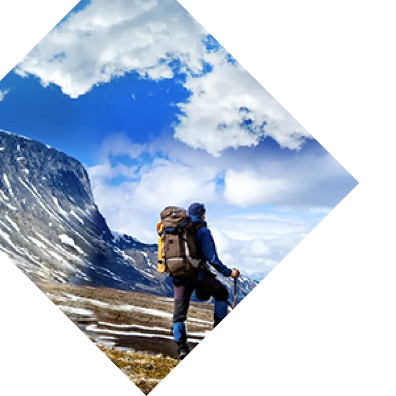
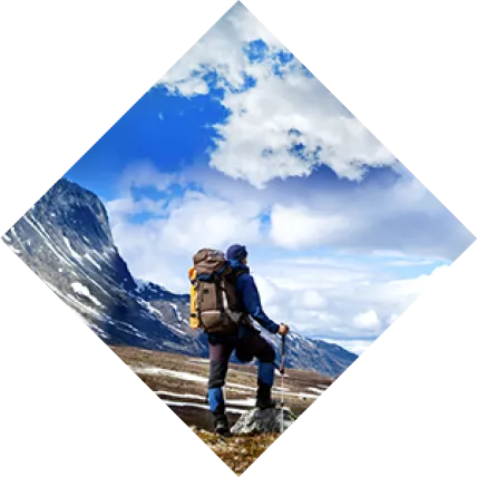
My fascination with the Appalachian Trail began 20 years ago. I distinctly recall a neighbor sharing stories of his six-month thru-hike adventure along the A.T. It seemed impossible and alluring at the same time. While it would be another 15 years before I began my own pilgrimage, thoughts of the trail never left my mind. The Appalachian National Scenic Trail, or simply the Appalachian Trail (A.T.), is more than 2,000 miles of continuous trail that connects Springer Mountain in Georgia and Mount Katahdin in Maine. The trail winds its way through 14 states, eight national forests, six national parks and beautifully diverse terrain. Hiking enthusiasts tend to approach the A.T. in three different ways:
- The daunting “thru-hike,” which can be done northbound or southbound, is a 2,000+ mile journey that sees the pilgrim, start to finish, and takes between five to seven months
- “Section hiking” is a popular way to get out into the woods for an extended period of time; usually a weekend to numerous weeks at a time
- “Day hiking" is just that, a day on the trail
 At 40 years old, married, with two kids and a job, a thru-hike was not in the cards for me. But, I had a friend with an equally unwavering desire to experience the A.T., so we decided to section hike the trail, 150 miles at a time. Even if you don’t have six months for a thru-hike, or two weeks to complete a big section, there are still other ways to enjoy this trail. And unlike me, you don’t have to wait 15 years to start. In fact, you could wake up tomorrow and do Three Forks to Springer Mountain section in a day! Three Forks to Springer Mountain
- Distance: 8.6 miles (Round Trip)
- Terrain: Moderately Difficult
- Location: Chattahoochee-Oconee National Forest off Forest Service Road 58
- GPS: 34.664183, -84.184317
- Parking: There is parking along Forest Service Road 58 adjacent to the trailhead
The first time I hiked this section of trail, I felt like I was in an enchanted forest. There were tunnels of rhododendron, towering hemlocks, quick-moving streams, and birds singing.  It was the second day of my first 150-mile section, and we hiked from the southern terminus of the trail, Springer Mountain, to Gooch Creek Shelter, a 15.8-mile day. As we hiked into the afternoon we found ourselves on Sassafras Mountain, praising the downhill sections and cursing the muscle-burning switchbacks. The shorter day hike from Three Forks to Springer and back certainly has some hilly sections, but the burn will pay off as it leads to wondrous surroundings. And instead of a 30-or 40-pound pack on your back, all you’ll need is your camera, water, and a packed lunch. This impressive and moderately difficult day hike begins by parking along Forest Service Road 58 at the convergence of Chester Creek, Long Creek, and Stover Creek. Right away, you’ll cross a wooden bridge spanning Chester Creek that sets you off toward the southwest (be sure to take in Stover Creek to your right). At .25 mile, you’ll pass the Benton MacKaye Trail on your left, stay straight and follow the rectangular white markings on the trees. They serve as your breadcrumbs on the A.T. Benton MacKaye Trail is blazed with white diamonds, but keep in mind that small portions of the trail do overlap. The A.T. descends into a beautiful canopy of rhododendron and mountain laurel with a trail surface of soft pine needle cover. Keep your eyes up and your hiking boots steady as there are plenty of rocks and roots at foot-level. You’ll cross Stover Creek many times as you wind back and forth over wooden bridges and stepping stones. While these additions help keep your feet dry, it’s not a bad idea to wear waterproof hiking boots. Keep your eyes and ears open as you’re bound to see wildlife: eastern towhees and dark-eyed juncos, blue violets, and chipmunks are plentiful. Breathe deeply as you take in the sights and smells of one of the most beautiful sections of the A.T. in Georgia. At three miles, after crossing Davis Creek and ascending the mossy creek valley, you’ll come to the Springer Mountain parking area. Cross the Forest Service Road and follow the white blazes back into the woods as you begin your final ascent to the summit of Springer Mountain. As you near the summit, you’ll pass the Springer Mountain Shelter on your left. Sweeping vistas emerge and wildflowers color your final approach. At 4.3 miles, the hike reaches the historic southern terminus of the trail. Check out the plaques and white blaze No. 1 as you enjoy a lunch on the rocky outcrop overlook. Enjoy a picnic, hydrate for the return trek, and enjoy the company of fellow hikers assembled on this famous spot.
  If you’ve got anything left in your engine after the return trek, you can hike one mile north on the A.T. from Three Forks and experience Long Creek Falls. Not only is it one of the most beautiful attractions on the Georgia A.T., but after a long hike, it’s a great place to kick off the boots and socks to soak your feet. This double cascade waterfall is only a few hundred feet off the trail and very well marked. At one mile north of Three Forks, you’ll come to the intersection of the Benton MacKaye trail and the side trail to the falls. Long Creek Falls trail will guide you to the final reward. Just a friendly reminder— complete this hike and the Appalachian Trail is sure to call you back for more!