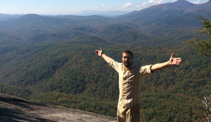
The Asheville area in North Carolina boasts some of the best hiking in the Southeastern US. As close as 9 miles from downtown, there are trails that are convenient for you and your schedule. Whether you have a few hours or a full day, you want to swim or stay dry, you are a marathoner or an ambler — this list has the perfect hike for you! 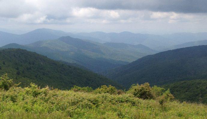
1. Rattlesnake Lodge
This easy hike along the Mountains to Sea Trail takes you to the ruins of a private vacation retreat from the early 1900s nestled amid tulip poplars and oaks. Length: 2.6 miles, round trip Type: out and back Difficulty: easy - about 600 feet of elevation gain Access: Ox Creek Road is about 6 miles north of the Folk Art Center on the Blue Ridge Parkway. Park about one mile up Ox Creek Road. Driving distance and time from downtown Asheville: 9 miles / 21 minutes
2. Skinny Dip Falls
This short hike is a quick way to beat the heat of the summer and get a chance to take a dip in a waterfall! Because of its proximity to the Looking Glass overlook on the Blue Ridge Parkway, it is very popular in the summer, so consider a weekday visit. Length: 2 miles, round trip Type: out and back Difficulty: easy - features rough ground and a long staircase with 250 feet of elevation gain Access: Park at the Looking Glass Overlook on the Blue Ridge Parkway - mile 417 Driving distance and time from downtown Asheville: 55 minutes / 33 miles
3. John’s Rock
This fantastic loop hike offers beautiful, wide views of Looking Glass Rock and the Blue Ridge without the crowds. Length: 5 miles Type: Loop Difficulty: moderate - about 1,000 feet of climbing Access: Park at the Pisgah Center for Wildlife Education and Fish Hatchery. This is off FSR-475 off Highway 276 near Brevard, NC. Driving distance and time from downtown Asheville: 50 minutes / 38 miles
4. Looking Glass
 This hike is popular for one simple reason: the views from the top. Expect wide 180-degree panoramas and plenty of people on nice weekends. Go early in the day, or better yet, mid-week. Length: 5.3 miles, round trip Type: out and back Difficulty: strenuous - 1,700 feet of climbing Access: Take FSR-475 off Highway 276 near Brevard. The well-marked trailhead will be on the right. Driving distance and time from downtown Asheville: 55 minutes / 44 miles
5. Black Balsam and Sam’s Knob
Hiking through rhododendron, mountain laurel and open fields at 6,000 feet results in jaw-dropping scenery. This is one of the best hikes in the area. Many side trails and add-ons can easily accommodate multi-day adventures on the Art Loeb Trail. Length: 2.2 miles round trip to Sam’s Knob Type: out and back Difficulty: moderate - 600 feet of elevation gain Access: The large parking area is 2 miles down Black Balsam Road from mile 420 on the Blue Ridge Parkway. Driving distance and time from downtown Asheville: 60 minutes / 37 miles
6. Lover’s Leap
This hidden gem on the Appalachian Trail offers wide views of the French Broad River below. Access is in the charming town of Hot Springs. Length: 1.8 miles Type: Loop Difficulty: moderate - 500 feet of climbing Access: Take Highway 25 north to Hot Springs. Turn right onto Silvermine Road just before crossing the French Broad River. Take an immediate left and go under the bridge. A small parking area is on the right. Driving distance and time from downtown Asheville: 46 minutes / 36 miles
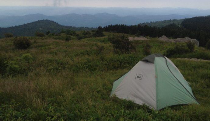
7. Max Patch
This grassy bald, the southern Appalachian name for a hilltop without any trees, features high winds and 360-degree views. You can head straight for the summit or hike around the bald; it’s up to you. The trail is the Appalachian Trail and you are actually hiking along the NC/TN state line. Length: 1.4 mile (out and back), 2.4 mile loop Type: out and back or loop Difficulty: moderate - under 500 feet of elevation gain Access: Head to 7163 Max Patch Road. From Asheville, head west on I-40 and exit for Route 209. Head north. This route is not for those prone to being carsick. Take routes 1334 and 1182 to the parking area. Driving distance and time from downtown Asheville: 75 minutes / 47 miles Whether you’re an Asheville resident or just visiting, be sure to get out and explore least one of these beautiful hikes. No matter your ability level or how much time you have, Asheville has the right hike for you!