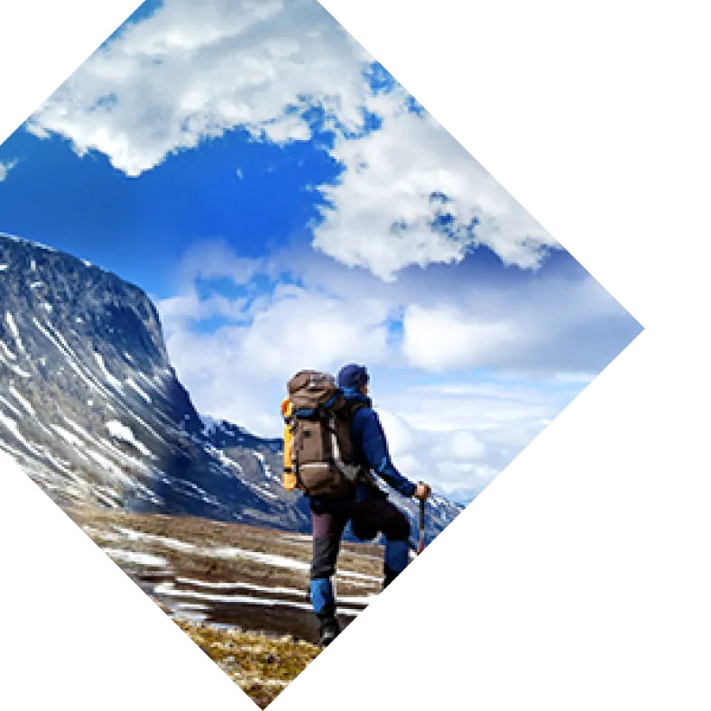
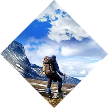
 Born and raised in Arizona, I wanted to leave the state as quickly as possible once I was old enough to roam. It’s funny, though — the longer I was away, traveling and living in other states, the more I realized how special Arizona is. So I moved back. While away, I grew to appreciate how the landscape transforms from north to south, east to west; canyon-laden high desert turns into forests, and mountains turn into red rocks, and rivers turn into saguaro-filled desert, which turns into high grass and hills. Drive two hours in Arizona and you’ll find yourself in completely different terrain than you started. You really can’t go wrong when hiking in Arizona, no matter which part of the state you’re in. I chose these eight hikes to represent a few of the diverse landscapes you can find in Arizona, from north to south.
Cathedral Wash Trail (Glen Canyon/Grand Canyon)
Round-trip Length: 3.1 miles Type of Trail: Out-and-back Elevation Gain: 377 feet Difficulty: Moderate Family/Dog Friendly: Yes (Older Kids)/No Trailhead Location: Turn off State Route 89A onto Lees Ferry access road; trailhead is 1.3 miles down the road at a pull-out on your left The Cathedral Wash trail starts in Glen Canyon National Recreation Area in northern Arizona and ends at the Colorado River in the Grand Canyon. That alone should tell you that this is an incredibly scenic trek. The trail follows a wash through colorful cliffs — sections of the Kaibab Limestone and Toroweap formations. There are a few areas where you have to scramble over rocks, but take your time and the hike isn’t too difficult. Oftentimes, hikers have this little-known trail to themselves, or will only encounter a few others along the trail. Be prepared, though, to see wildlife, as coyotes, bighorn sheep, birds, rattlesnakes, and lizards call this land home. On a hot day, the cool waters of the Colorado River are a refreshing way to end this hike. Make sure to brush up on your desert hiking skills before you head out.
White House Trail (Canyon de Chelly National Monument)
Round-trip Length: 2.7 miles Type of Trail: Out-and-back Elevation Gain: 554 feet Difficulty: Moderate Family/Dog Friendly: Yes/Yes, leashed Trailhead Location: White House trailhead on South Rim Drive Canyon de Chelly National Monument in northeastern Arizona is completely underrated. I don’t use the phrase “hidden gem” often, but that’s the term that comes to mind when I think of this park in the Navajo Nation. Canyon de Chelly is a unique park because Navajo families continue to live on this land, farming and raising sheep, and many hikes are accessible only by Navajo guides. The White House trail, however, is available to explore on-the-fly, sans guide. It’s a bit of a steep hike to the bottom of the canyon floor, but the switchbacks make the descent manageable. Plus, the views on the way down are beautiful, so you hardly notice the 600-foot drop. Once you reach the bottom, you’ll cross Chinle Wash and end at ancient Puebloan ruins that are spectacularly set into a sheer sandstone cliff. This hike is the perfect mix of nature and history.
Lava River Cave (Flagstaff)
Round-trip Length: 1.6 miles Type of Trail: Out-and-back Elevation Gain: 9 feet Difficulty: Easy-Moderate Family/Dog Friendly: Yes (Older Kids)/No Trailhead Location: GPS coordinates: 35.342278, -111.835611 — end of Fire Road 171B Not many people know that within the ponderosa pine trees near Flagstaff, there’s a 700,000-year-old lava tube cave that you can hike into. This cave originated when a volcanic vent near Hart Prairie erupted, creating a lava river that eventually emptied out and formed the cave. It’s an unexpected and eerie place to explore if you have a couple hours to spare. The cave stays cold year-round — about 35 to 45 degrees Fahrenheit — so layer up, even in the summer. Good waterproof hiking boots are a must, as you’ll be trekking over a rocky and sometimes slippery surface. (I have a friend who tried to do the hike in Toms, and really regretted it.) Make sure to bring one flashlight and headlamp per person, as there are no light sources in the cave once you descend past the sunlight’s reach.
Watson Lake Loop (Prescott)
Round-trip Length: 4.8 miles Type of Trail: Loop Elevation Gain: 377 feet Difficulty: Moderate Family/Dog Friendly: Yes/Yes, leashed Trailhead Location: Watson Lake Park Watson Lake is no ordinary lake. It lies within the Granite Dells, an area of massive granite boulders in Prescott. Half of the lake is lined and dotted with weathered rocks, which are fun to climb over on parts of the trail. (Just make sure to wear shoes with good traction.) The flat section of the trail winds through a marshy riparian area, where many species of birds can be seen, from herons to bald eagles. Hiking the loop around the photogenic Watson Lake is a great way to start or end the day, as the lake is particularly lovely around sunrise and sunset, when the granite and the sky’s colors create a stunning reflection. Trail runners, families, and people with dogs all love this hike year-round, though ice and snow makes the hike more challenging in winter.
Houston Brothers Trail (Mogollon Rim)
Round-trip Length: 14.3 miles Type of Trail: Out-and-back or point-to-point (North and South trailheads) Elevation Gain: 1,627 feet Difficulty: Moderate Family/Dog Friendly: Yes/Yes, leashed Trailhead Location: Check the trail’s U.S. Forest Service information for directions to both trailheads If you want to meander through lush forest and fern-filled meadows in solitude, this hike on the Mogollon Rim is for you. The only other beings on this trail are likely to be wildlife, as a variety of animals are drawn to the perennial stream that flows through the valley. The peaceful sound of the trickling stream will accompany you off-and-on as you follow the trail’s gentle ups and downs. This trail has a history of different purposes. Now used recreationally, it was once used by the Forest Service as a pathway to remote cabins where firefighters could monitor the Coconino National Forest for signs of wildfires. Ranchers (the Houston Brothers) also used the trail to travel with their livestock. Don’t be surprised if you see signs of past human use within the forest. Mostly, though, you’ll see untouched nature. If you have a hammock, bring it — these trees are perfect for laying back on a mid-hike break. Note that the Houston Brothers trail has two trailheads, so it can be done as a point-to-point hike if you arrange transportation at the other end.
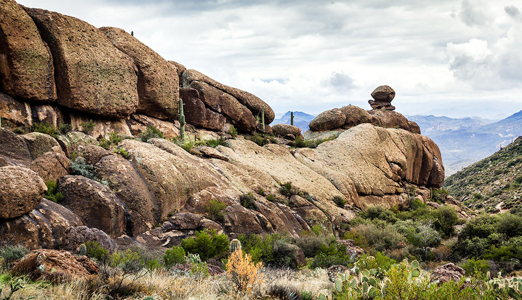
Peralta Trail (Phoenix Area)
Round-trip Length: 4.9 miles Type of Trail: Out-and-back Elevation Gain: 1,345 feet Difficulty: Moderate Family/Dog Friendly: Yes/Yes, leashed Trailhead Location: Peralta trailhead parking lot at the end of Peralta Road The Peralta trail, an hour from downtown Phoenix, is a great way to explore the Sonoran desert and, more specifically, the Superstition Wilderness. If you want to see Saguaro cactuses — perhaps the most iconic desert plant in the world — there are plenty along the trail. Palo Verde trees, Arizona’s state tree, also call the area home. This boulder-filled landscape will have you in awe, especially when you reach the saddle and have a sprawling view of impressive desert and Weavers Needle, a tall column of rock that dominates the scenery. This trail is not recommended in the summer, as desert temperatures frequently soar past 100 degrees Fahrenheit. Any time of year, bring plenty of water. Due to the trail’s beauty and proximity to Phoenix, it’s especially busy on weekends and during the spring when poppies are in bloom. Start early to avoid the crowds if you plan to hike during these times.
Echo Canyon Loop (Chiricahua National Monument)
Round-trip Length: 3.5 miles Type of Trail: Loop Elevation Gain: 524 feet Difficulty: Moderate Family/Dog Friendly: Yes/No Trailhead Location: Echo Canyon Trail parking area off Bonita Canyon Drive Utah’s Bryce Canyon is known for hoodoos, but Arizona has them too. Chiricahua National Monument, in the southeast corner of Arizona, is chock-full of these towering rock formations. The Echo Canyon Loop showcases the best of them, which is why it’s one of the most popular trails in the park. That isn’t saying much, though, because Chiricahua National Monument only received 63,000 visitors in 2017 — a far cry from many of Arizona’s other parks that are more popular. Chiricahua is a place of breathtaking and surprising magnificence. The only reason more people don’t visit is because it’s fairly remote — about a four-hour drive from both Phoenix and El Paso. But if you make it to Chiricahua National Monument, there’s plenty to see on the Echo Canyon trail alone. You’ll find not only hoodoos but also grottoes, a forested cove, a stream (during winter and spring), and panoramic views of geologic formations that dot the landscape as far as the eye can see. Going counterclockwise, the route is pretty easy except for an uphill climb toward the end, so families with children enjoy this trail.
Patagonia Lake Overlook Trail (Southern Arizona)
Round-trip Length: 1.4 miles Type of Trail: Out-and-back Elevation Gain: 311 feet Difficulty: Easy Family/Dog Friendly: Yes/Yes, leashed Trailhead Location: GPS coordinates: 31.487606, -110.865840 — take the last left on Patagonia Lake Road before you hit the entrance station for the state park, and you’ll run into the parking area on the left Southern Arizona, near Mexico, is full of vineyards, rolling hills and grasslands. It’s not what anyone thinks of when they picture Arizona landscapes. This short, easy trail near Patagonia Lake State Park and Sonoita Creek State Natural Area shows off that scenery and is great for any hiker, including the four-legged variety. Throughout the tall yellow grass, you’ll find desert plants such as ocotillo (tall, spindly shrubs) and barrel cactuses. Keep an eye out for whitetail deer on your way up the hill. When you get to the top, the star of the scene is Patagonia Lake, a 265-acre glittering gem in the desert that’s a popular place to fish and boat. On a hot day, head to the lake for a cool swim after hiking. Many species of birds also appreciate the water, including great blue herons and turkey vultures, making the park a haven for birdwatchers.